Classroom Shape Generator – Premium Geometry Tool for Teachers
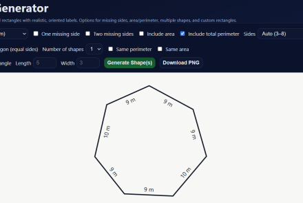
The Classroom Shape Generator is a premium teacher-only math tool designed to help educators quickly create high-quality geometry, area, and perimeter practice materials. Registered teachers gain access to a powerful shape-building tool that generates custom rectangles and polygons with accurate side-length labels, optional missing sides, and calculated area and perimeter values.