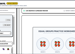
Unlock Premium Teacher Access
🔓 Unlock Premium Teacher Access
Everything you need. One simple yearly plan.
Upgrade to Premium and get full access to all current and future content—designed to save you time, boost engagement, and support real classrooms.
✅ What’s included with Premium
-
Unlimited access to all content on the site
-
Exclusive teacher tools to plan, practice, and assess faster
-
Future Teachers Pay Teachers resources included
(All my current and upcoming TPT products will be added at no extra cost) -
New content added regularly—your subscription grows in value over time
💲 Simple, affordable pricing
$20 per year
Less than $2 a month for tools you can use all year long.
🎯 Who Premium is for
-
Classroom teachers who want ready-to-use resources
-
Teachers who like games, tools, and engagement
-
Anyone tired of buying the same types of resources over and over
Upgrade to Premium
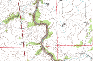
In this activity, students will engage in a topographic map exercise. When a student is finished they will understand what contour lines, elevation, contour interval, contour index, and quadrants are. Students will analyze a map of Snowflake AZ, you can pick your own map if you wish, and discover why it is important to understand topographic maps.
For more Earth Science Labs and Resources visit EarthScience.xyz